|
|
| ||||||
|
PERUGIA Transport in town -
How to reach Perugia by car
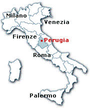
Umbria is the only region of the Italian peninsula with no coastline. The geographical heart of Italy, Umbria is closed in by Tuscany to the west, Emilia Romagna to the north, the Marches to the east, and Lazio (Latium) to the south. Umbria is divided into two provinces (Perugia and Terni). Its popoulation amounts to roughly 800,000 people that live in 92 comuni spread over an area of 8,500 sq. km (3,280 sq. miles).
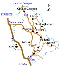
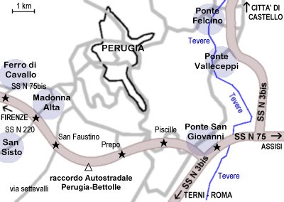
The city of Perugia is the capital of the province named after it, as well as the capital city of the entire region. Situated on a hill, Perugia has a population of just 150,000 and is connected to the rest of the country by a well developed network of roads. The two major arterial roads are the SS3bis (also called E45), which runs along the Tiber valley, and the SS75bis, called "Raccordo Perugia-Bettolle". The A1 The Rome - Florence motorway (the "Autostrada del Sole"), skirts the western borders of Umbria and is connected to Perugia by the "Raccordo Perugia-Bettolle". Getting to Perugia by car:
From the north (Milan, Florence), the best exit for Perugia on the A1 motorway at Valdichiana, where the superstrada SS75bis branches into Umbria at Lake Trasimene and continues towards Perugia. From Rome travelling northwards along the A1 motorway the best exit for reaching Perugia is at Orte, which is connected to the regional capital at first by the ss204 to Terni and then by the E45 (or SS3bis) from Terni to Perugia.
Perugia Online © Copyright 1997-2025 by SCG Business Consultig Sas di E.Giacomelli (www.scgconsulting.com) | |||||||


